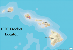
STATE OF HAWAI`I LAND USE DISTRICT BOUNDARIES MAPS
How to use this feature:
- Click on the map below to find information about State Land Use District Boundaries, LUC Docket Numbers, and counties Tax Map Key Numbers (TMK) using our ArcGIS Online web map application.
- After the application opens, zoom in (clicking twice – zooming in) to the island/area that you are interested or the appropriate zoom features of your device or the + or – symbols on the blue bar located at the bottom of the page.
- As you zoom in closer greater detail of information will be seen. The information/data will only be apparent once you’ve zoomed in close and click once to select and a popup table shall appear. Please make note of information/data to use and find within our LUC website.
Some of the documents on this website may contain live references (or pointers) to information created and maintained by other organizations. Please note that the LUC does not control and cannot guarantee the relevance, timeliness, or accuracy of these outside materials.
This map was produced by the Land Use Commission (LUC) for informational purposes only. This map and all the information contained within shall not be used for boundary interpretation. The authoritative boundary lines between State Land Use District Boundaries are found on the official U.S.G.S. quadrangle maps currently filed at the LUC and may be further defined by officially-recognized LUC Boundary Interpretations supported by metes and bounds descriptions.
Information presented on this website is considered public information (unless otherwise noted) and may be distributed or copied. Use of appropriate byline/photo/image credit is requested. We strongly recommend that LUC data be acquired directly from the LUC website and not through other sources that may change the data in some way. While the LUC makes every effort to provide accurate and complete information, various data such as names, telephone numbers, etc. may change prior to updating. The LUC provides no warranty, expressed or implied, as to the accuracy, reliability or completeness of furnished data.
