LAND USE DISTRICT BOUNDARIES MAPS – Island of Hawai`i
These maps were produced by the Land Use Commission (LUC) for informational purposes only. These maps and all the information contained within shall not be used for boundary interpretation. The authoritative boundary lines between State Land Use District Boundaries are on the official U.S.G.S. quadrangle maps currently filed at the office of LUC and may be further defined by officially-recognized LUC Boundary Interpretations supported by metes and bounds descriptions.
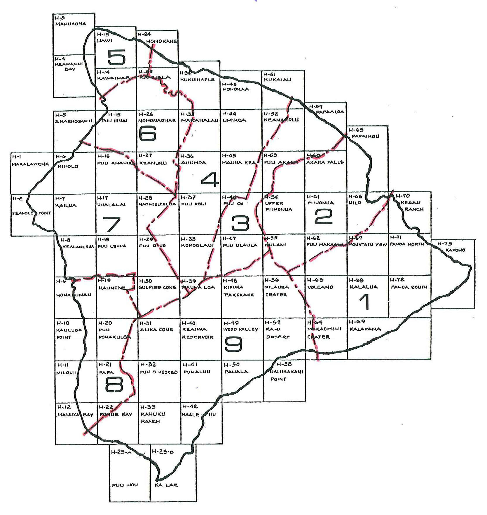
The quadrangle name and State Land Use Number can be located in the upper left corner of each grid square in the diagram below of the island of Hawai`i. The following list provides the quadrangle names and State Land Use Number including the direct links to a digital quadrangle map. The other large numbers and red dashed lines seen on the map diagram below delineate the Tax Map Key “Zone Number” as utilized by the county.
Hawai`i Quadrangle Locator, *Click on Image To Enlarge
Hawai`i (pdf):
H-1 Makalawena, H-2 Keahole Point, H-3 Mahukona, H-4 Keawanui Bay, H-5 Anaehoomalu, H-6 Kiholo, H-7 Kailua, H-8 Kealakekua, H-9 Honaunau, H-10 Kauluoa Point, H-11 Milolii, H-12 Manuka Bay, H-13 Hawi, H-14 Kawaihae, H-15 Puu Hinai, H-16 Puu Anahulu, H-17 Hualalai, H-18 Puu Lehua, H-19 Kaunene, H-20 Puu Pohakuloa, H-21 Papa, H-22 Pohue Bay, H-23-A Puu Hou, H-23-B Ka Lae, H-24 Honokane, H-25 Kamuela, H-26 Nohonaohae, H-27 Keamuku, H-28 Nohueleelua, H-29 Puu O Uo, H-30 Sulphur Cone, H-31 Alika Cone, H-32 Puu Keokeo, H-33 Kahuku Ranch, H-34 Kukuihaele, H-35 Makahalau, H-36 Ahumoa, H-37 Puu Koli, H-38 Kokoolau, H-39 Mauna Loa, H-40 Keaiwa Reservoir, H-41 Punaluu, H-42 Naalehu, H-43 Honokaa, H-44 Umikoa, H-45 Mauna Kea, H-46 Puu Oo, H-47 Puu Ulaula, H-48 Kipuka Pakekake, H-49 Wood Valley, H-50 Pahala, H-51 Kukaiau, H-52 Keanakolu, H-53 Pua Akala, H-54 Upper Piihonua, H-55 Kulani, H-56 Kilauea Crater, H-57 Kau Desert, H-58 Naliikakani Point, H-59 Papaaloa, H-60 Akaka Falls, H-61 Piihounua, H-62 Puu Makaala, H-63 Volcano, H-64 Makaopuhi Crater, H-65 Papaikou, H-66 Hilo, H-67 Mountain View, H-68 Kalalua, H-69 Kalapana, » H-70 Keaau Ranch, H-71 Pahoa North, H-72 Pahoa South, H-73 Kapoho
» Not Scanned/Posted at This Time